Sunday, October 01, 2000
Bryce Canyon - Oct 1
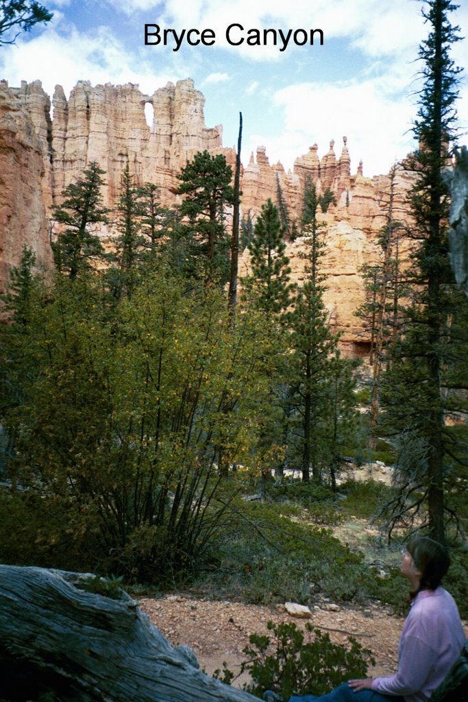 This is our last full day at Bryce Canyon NP, one of the most beautiful places on earth. Also one of the most popular. After weeks of hiking and seeing no more than 10 or 12 people all day, we were jolted to find scores of people gawking and gaping at every overlook, and usually speaking a foreign language. Evidently, every travel agency in Europe (and probably Japan) has a large poster of Bryce Canyon prominently displayed, and people walk in, gasp, and say "I want to go there!" Consequently, roughly two thirds (our estimate) of the people you meet here are from out of the country. We also discovered that there is a certain sameness to the overlooks. The best way to experience Bryce is from its trails, where you look up at the fabulously shaped hoodoos, spot new windows around every turn, and feel overwhelmed by the changing majesty every 50 feet. R.W. Emerson said it best: "When you have worn out your shoes, the strength of the shoe leather has passed into the fabric of your body. I measure your health by the number of shoes and hats and clothes you have worn out. He is the richest man who pays the largest debt to the shoemaker."
"Bryce Canyon" is really a misnomer -- Bryce is not a canyon, but a series of amphitheaters carved from a cliff by water. Running water, however, is not the main culprit here -- Bryce is situated such that the temperature is below freezing during the night and above freezing during the day over 200 times per year. This frequent freeze/thaw cycle is the cause of the weirdly shaped hoodoos, geologists believe.
We spent three days hiking in Bryce -- first we combined Navajo and Peekaboo Loops. Navajo is a 1.3 loop, which drops swiftly down between two fins in continuous switchbacks, then meanders through more hoodoos, and then switchbacks up to the starting point. A spur at midpoint leads to Peekaboo, which is a 3-mile loop that rises and falls over 3 or 4 ridges, offering dramatic views of the surrounding area. The next day we hiked Queen's Garden, which is Bryce's most popular trail. It descends steeply through wide, open terrain before leading into Queen's Garden, home of over 50 named hoodoos. Most of the names have been retired, due to the rapid change of the features. We truly saved the best for last when we hiked Fairyland Trail, the remotest, most varied, and least popular trail -- 5.5 miles of exquisite, ever-changing scenery. This trail alone would beckon us back to Bryce.
We also took a daytrip to Kodachrome Basin SP, named by a 1948 National Geographic Society expedition to the area. Kodak evidently did not take exception to its trademarked line of color film being associated with this colorful area. And yes, that's the only brand of film available at the Visitor Center. Geologists believe that KB used to be a thermal basin similar to Yellowstone, and that the tall spires dotting the park are the visible remains as the surrounding sandstone eroded away. We started down a 10-mile dirt road leading to Grosvenor Arch, but it was raining, and we started to slide, despite 4WD. We had been warned that the worst was yet to come, so decided to save the arch for another time.
# posted by Doug and Willie @ 5:46 PM 
![]()